This 2 hour interactive online course presents ONE 
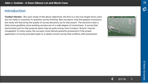
interesting land boundary case that is particularly instructional as to the proper application of the principles of boundary location for LOT AND BLOCK parcels. It introduces many of the principles of boundary surveying in a systemmatic fashion.
The problem statement will suggest alternate approaches, principles, and solutions. You must solve the case according to what you think is the proper application of survey principle. You will then compare your solution with DAVE GIBSON''S 'best practices' solution which incorporates the correct application of boundary location principles. Defense for the 'best practices' solution will be given for consideration and further learning by the attendee.
If you love to discuss tough boundary location situations, then you will love this case and learn something new. You will also learn other viewpoints for your consideration. The beginner can benefit from the instruction they give as much as the experienced practitioner.
This course is a portion of the longer 6 hour course titled 'Dave Gibson''s All Star Lot and Block Boundary Cases' also offered on RedVector.com.
This course includes a multiple-choice quiz at the end.
Vector Solutions has a long history of providing industry-specific content for its customers. While this course and its content remain accurate and functional within our systems, the look and feel may not match our more modern offerings.
At the conclusion of this course, the student will reach the following objectives:
All Course Materials Copyrighted
Dave Gibson, 2002
Narrow Your Search Here or Select Your State(s) Below:
Click on the state to expand the license or professional organization that applies to the course.
Dave Gibson is the founding Program Director of the Geomatics Program at the University of Florida. He holds a Bachelor’s degree from the University of Cincinnati (1967), a Master of Science degree from the University of Miami (1970), and has recently completed a Ph.D. program at the University of Alabama (2002). He holds academic interest and has instructed courses in a broad sector of the geomatics field including geographic information systems, mapping, cadastral systems, route design, and photogrammetry. Research interests include the economic evaluation of information systems, land boundary definition and resolution, riparian rights, and methods of building base layers for geographic information systems.
In Florida, he has been active in GIS, holding a gubernatorial appointment as founding chair of the state’s base mapping advisory committee (BMAC) and a charter appointment to the state’s Geographic Information Board (GIB). Professional activities include more than twenty years with ABET, the Accreditation Board for Engineering and Technology, where he has served at the commission level and on the ABET board for several appointments. He recently held a gubernatorial appointment to the Florida Board of Professional Surveyors and Mappers for two terms, serving as board chair for two years. For nearly 25 years, he has been active in the surveying examination program of the NCEES, currently serving as surveying examination consultant. He has also served in numerous professional associations including the Florida Surveying and Mapping Society, the American Congress on Surveying and Mapping, the American Society for Photogrammetry and Remote Sensing, and the Urban and Regional Information System Association.
He is the author of a nationally distributed textbook, “Route Surveying and Design, 5th Edition” by Meyer and Gibson, and has instructed numerous continuing education seminars for surveyors and mappers.
© 2023 VectorSolutions.com All Rights Reserved. Terms and Conditions | Privacy Policy i-0897e5ca522108363